Current Auction
Scarce, Complete Octavo Edition of Pacific Railroad Reports
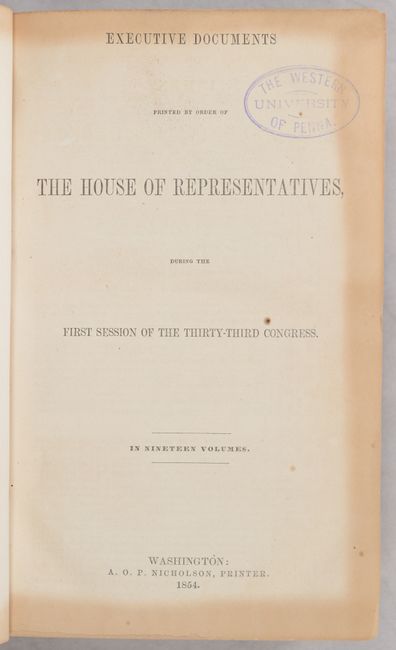
"[3 Volumes] Report of the Secretary of War Communicating the Several Pacific Railroad Explorations", U.S. War Department
Subject: Exploration & Surveys, Pacific Railroad
Period: 1855 (published)
Publication: H.R. Doc. 129, 33rd Congress, 1st Session
Color: Black & White
Size:
6 x 9.3 inches
15.2 x 23.6 cm
Download High Resolution Image
(or just click on image to launch the Zoom viewer)
(or just click on image to launch the Zoom viewer)
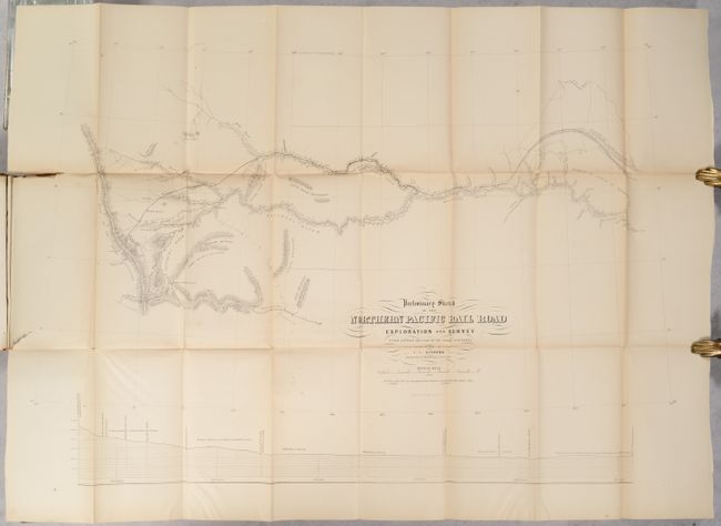
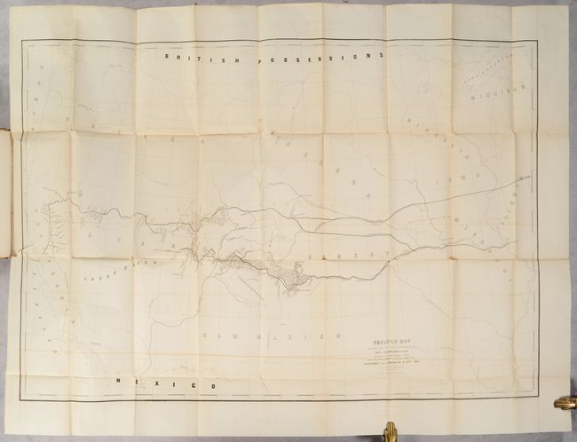
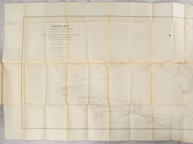
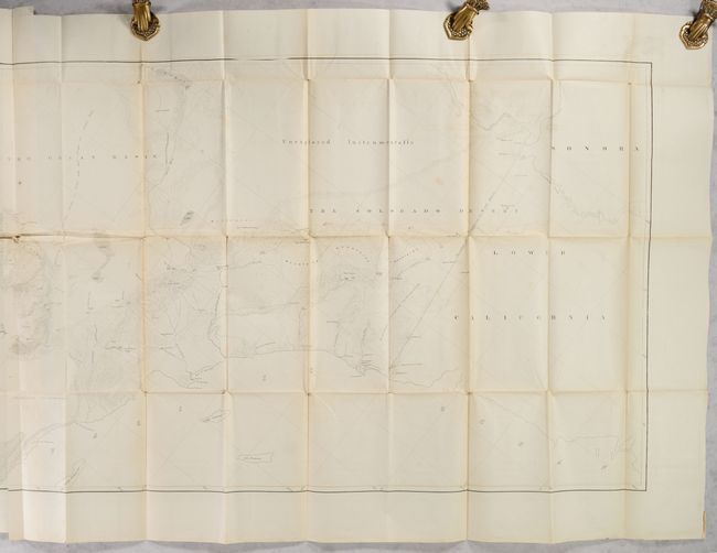
These three volumes contain the reports and maps that provided Congress with the first comprehensive view of large sections of the American West. Congress authorized these surveys to seek the best route for a transcontinental railroad. Anxious to know what had been learned to date, Congress ordered the preliminary reports to be published in 1854 in this octavo format. Subsequently, these reports with additions were published in twelve large quarto volumes from 1855 to 1861. Volume one contains the reports of Humphreys and Warren, Jesup and Stevens, and volume two includes reports by Beckwith (2), Whipple and Pope. Each report is separately paginated. The third volume includes 14 large folding maps, as issued:
1. Preliminary Sketch of the Northern Pacific Rail Road Exploration and Survey from St. Paul to Riviere Des Lacs,by I.I. Stevens
2. Preliminary Sketch of the Northern Pacific Rail Road Exploration and Survey from the Riviere Des Lacs to the Rocky Mountains,by I.I. Stevens
3. Preliminary Sketch of the Northern Pacific Rail Road Exploration and Survey from the Rocky Mountains to the Puget Sound,by I.I. Stevens
4. Skeleton Map Exhibiting the Route Explored by Capt. J.W. Gunnison ... 38th Parallel ... 41st Parallel,by E.G. Beckwith
5. General Profile from Westport Near the Western Border of the State of Missouri to the Sevier River, Great Basin
6. Map No. 1, Reconnaissance and Survey of a Railway Route from Mississippi River near 35th Parallel,by A.W. Whipple
7. Map No. 2, Reconnaissance and Survey of a Railway Route from Mississippi River near 35th Parallel,by A.W. Whipple
8. Profile of a Route from San Pedro on the Pacific Coast to Memphis on the Mississippi River
9. Map of the Survey of a Route for the pacific Railroad near the 32nd Parallel,by Captain Pope
10. Route of a Survey from the Pimas Villages on the Rio Gila to Mesilla...,by Jno. G. Parke
11. Profile of Route from Pimas Villages on the Rio Gila to Mesilla on the Rio Bravo,by Jno. G. Parke
12. General Map of a Survey in California in Connection with Examination for Railroad Routes to the Pacific Ocean,by R.S. Williamson
13. Profiles of Six Passes
14. Profiles of Five Passes
The map volume is labeled "Part 4" on the spine, as a third volume of text was initially contemplated; however, only one further report was issued with the same document number (appearing in 1856 by Frederick W. Lander), and only two copies of this report are known to exist, according to Howes. Therefore this 3-volume set is considered as a "complete" set of this report.
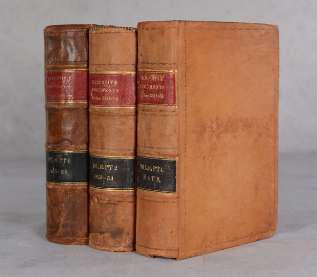
3 Volumes. Hardbound in full tan contemporary leather with red and black leather labels on spines with titles and volume numbers in gilt.
References: Howes #P-3; Koepp (CIS) #739; Wagner-Camp #261:1 & #261:2.
Condition: B+
The maps are in very good condition for these types of reports with short fold separations and short binding tears. There are occasional spots, offsetting, toning along the folds, and misfolds. A few of the maps have longer binding tears of 4-6" without any loss. Two of the maps are detached from the volume. The text volumes have minor foxing and toning. There are old library stamps from The Western University in Pennsylvania on the front free-endpaper and title page of Volume 1. There are dampstains on the first and last 5-6 pages of Volume 2, and this volume is missing the front free-endpaper. There are numerous pencil notations (primarily descriptions of the contents) from a previous owner on the pastedown and front free-endpapers on each volume. The covers have light wear, abrasions, and soiling. Volume 1 has been professionally rebacked using the original boards and spine backstrip. Volume 2 has a large chip on the front cover that has been replaced with a new piece of leather.
Estimate: $2,000 - $2,400
Current High Bid:
$1,500
Reserve: Reserve Met
Next Bid: $1,600
Bid Increments
$1,000 - $2,499$100
$2,500 - $4,999$250
$5,000 - $9,999$500
$10,000 - $24,999$1,000
Terms & Conditions