Current Auction
NO RESERVE
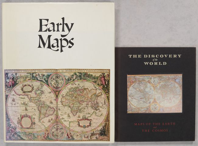
"[Lot of 2] Early Maps [and] The Discovery of the World - Maps of the Earth and the Cosmos"
Subject: References
Period: 1981-85 (published)
Publication:
Color: Printed Color
Size:
See Description
Download High Resolution Image
(or just click on image to launch the Zoom viewer)
(or just click on image to launch the Zoom viewer)
A. Early Maps, by Tony Campbell, published 1981 (12.2 x 15.3"). This reference book contains an array of early maps, municipal plans, and sea charts from the 13th century to the 1850s. Each plate is accompanied by information on the cartographer and an explanation of the political developments and geographical discoveries that influenced the map's design. Hardbound in green cloth with gilt letters on spine and illustrated original dust-wrapper. 148 pp., 68 color plates, several foldouts. Condition: Text is very good with some abrasions along the gutter on pages 90 and 91. Bottom corners of the covers are lightly rubbed. Dust jacket is lightly soiled with a couple tears on spine. (B+)
B. The Discovery of the World - Maps of the Earth and the Cosmos, by University of Chicago Press, published 1985 (9.1 x 10.6"). This handsomely produced catalogue presents choice maps from the collection of the David M. Stewart Museum in Montreal. The collection emphasizes "rare maps, globes and navigational instruments which illustrate and illuminate man's gradual discovery of the earth and the universe from the invention of printing in the mid-15th century up to the end of the French regime in Canada" (per Mrs. David M. Stewart in the preface). The book is illustrated throughout with illustrations in black & white and color. Also included are the essays "In Praise of Cartography" by Yves Berger; "Map-Making and Geography Traced in the David M. Stewart Collection" by Dr. Helen Wallis; and "French Cartographers of the 17th and 18th Centuries" by Monique Pelletier. 87 pages. Soft illustrated covers. Condition: Spine is faintly sunned and slightly bumped, otherwise near fine. (A)
References:
Condition:
See description above.
Estimate: $45 - $60
Current High Bid:
$1
Reserve: Reserve Met
Next Bid: $2
Bid Increments
Under $50$1
$50 - $99$5
$100 - $249$10
$250 - $499$25
$500 - $999$50
Terms & Conditions