Current Auction
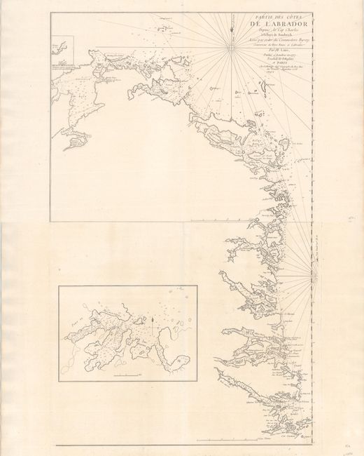
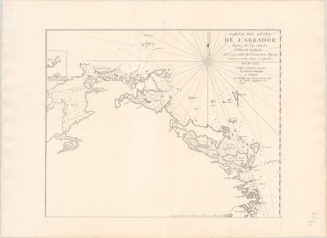
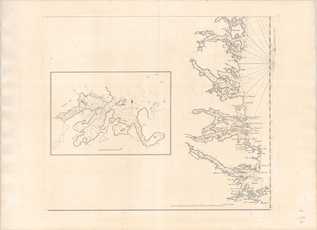
"[On 2 Sheets] Partie des Cotes de Labrador Depuis le Cap Charles a la Baye de Sandwich. Leve par Ordre du Commodore Byron...", Le Rouge, George Louis
Subject: Labrador, Canada
Period: 1777 (dated)
Publication: Pilote Americain Septentrional
Color: Black & White
Size:
21.3 x 17 inches
54.1 x 43.2 cm
Download High Resolution Image
(or just click on image to launch the Zoom viewer)
(or just click on image to launch the Zoom viewer)
This matching pair of charts give a detailed view of the coastline of Labrador from Sandwich Bay to Cape Charles. The coasts are filled with depth soundings, safe anchorages, tiny islands, and navigational hazards. A large inset on the southern sheet gives greater detail of Mecklenbourg Harbor, Port Charlotte, Mosquito Cove, and Sophia Harbour. Le Rouge based his maps on Thomas Jefferys maps and published them in his North American Pilot.
References: Shirley (BL Atlases) M.LER-1a #7,8.
Condition: A+
Sharp impressions on bright sheets with a large watermark of a Maltese cross encircled in rosary beads. Each sheet has two minute worm holes that have been professionally infilled. The first image is a composite image - the map is on two separate sheets.
Estimate: $550 - $700
Current High Bid:
$0
Reserve: Reserve Not Met
Next Bid: $275
Bid Increments
$250 - $499$25
$500 - $999$50
$1,000 - $2,499$100
$2,500 - $4,999$250
Terms & Conditions