Current Auction
"[Maps in Book] A New Map of the British Dominions in North America; with the Limits of the Governments Annexed Thereto by the Late Treaty of Peace... [bound in] The Annual Register, or a View of the History, Politicks, and Literature…", Kitchin, Thomas


Subject: Colonial Eastern United States & Canada, History Book
Period: 1776 (published)
Publication:
Color: Black & White
Size:
11.9 x 9.6 inches
30.2 x 24.4 cm
Download High Resolution Image
(or just click on image to launch the Zoom viewer)
(or just click on image to launch the Zoom viewer)
This very historical map illustrates the British colonies after the Treaty of Paris and at the conclusion of the French and Indian War in America. The treaty ended French colonial ambitions in North America with minor exceptions. As a result, Spain ceded East and West Florida to Great Britain, France relinquished the title to the Louisiana Territory to Spain, and the Mississippi River was established as the British-Spanish Boundary. The map reflects the claims of the southern colonies that their charters extended to the Mississippi River. Also of interest are the names and locations of many Indian tribes and nations located away from the more populated areas of English settlements. An inset of East Florida on the same scale lies between the coastline and the decorative rococo-style title cartouche. A simple compass rose rests in the Atlantic.
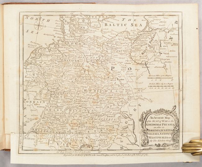
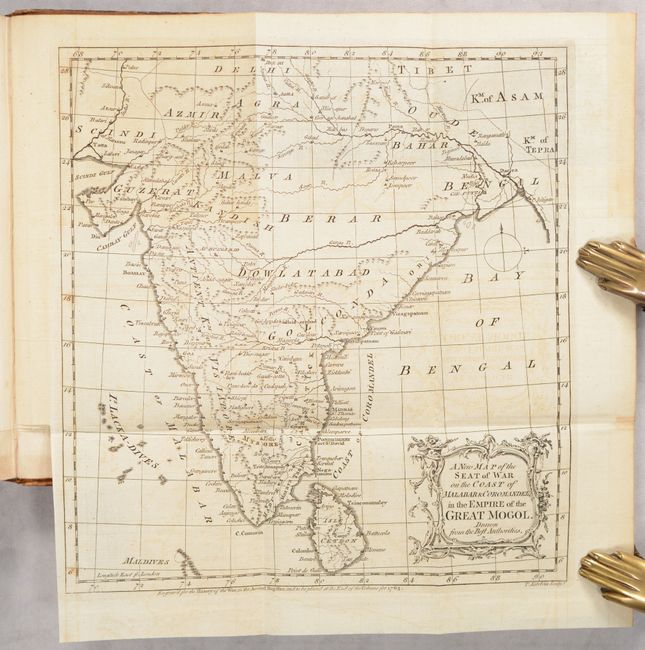
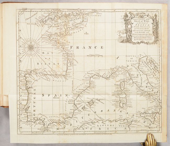
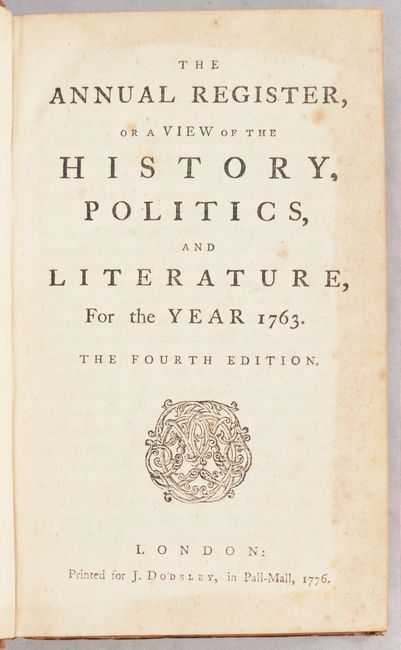
The map is still bound into the fourth edition of The Annual Register, or a View of the History, Politics, and Literature, For the Year 1763, published in 1776. The 307-page volume includes sections on the history of Europe, a chronicle of events, "characters" for the year, and four maps bound in at the end of the text. In addition to the map described above are: An Accurate Map of the Seat of War in the Kingdom of Prussia... (9.1 x 7.9"); A New Map of the Seat of War on the Coast of Malabar & Coromandel... (8.9 x 9.5"); and A New and Correct Chart of the Seat of War, on the Coasts of France, Spain, Portugal and Italy... (11.6 x 9.8"). Printed for J. Dodsley in London. Jolly notes that this is the only volume of the Annual Register to contain maps, and it went through a number of editions (at least 8). Octavo, hardbound in original leather boards.
References: Jolly #ANNREG-3; McCorkle #763.5; Sellers & Van Ee #103.
Condition: B+
The North America map is issued folding with light foxing and toning and light dampstaining along the right fold. The other 3 maps are also issued folding with light offsetting, toning, and/or foxing. Text is lightly foxed with light dampstaining in the front section of the book. Covers have a few minor abrasions and bumped corners.
Estimate: $600 - $750
Current High Bid:
$300
Reserve: Reserve Not Met
Next Bid: $325
Bid Increments
$250 - $499$25
$500 - $999$50
$1,000 - $2,499$100
$2,500 - $4,999$250
Terms & Conditions