Current Auction
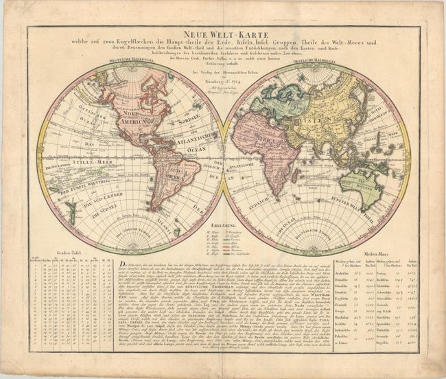
"Neue Welt-Karte Welche auf Zwoo Kugelflaechen die Haupt-Theile der Erde...", Homann Heirs
Subject: World
Period: 1784 (dated)
Publication:
Color: Hand Color
Size:
22.4 x 18.8 inches
56.9 x 47.8 cm
Download High Resolution Image
(or just click on image to launch the Zoom viewer)
(or just click on image to launch the Zoom viewer)
This interesting world map presents some curious cartography, given the date of the map. The Great Lakes are shown as one huge body of water and California is strangely shaped with the Baja nearly appearing as an island. Australia includes several place names on the eastern coast, which resulted from Cook's discoveries in 1770, however, Van Diemens Land is still shown connected to the mainland as it was not discovered to be an island until 1799. The tracks of several late 18th century expeditions are shown. There is a color key identifying the five continents and a German text panel fills the bottom portion of the engraving.
References:
Condition: B+
A nice impression with full contemporary color on a sheet with an Elias Kutter watermark. There is light soiling, mostly in margins, and a couple of soft folds along centerfold.
Estimate: $600 - $750
Current High Bid:
$0
Reserve: Reserve Not Met
Next Bid: $300
Bid Increments
$250 - $499$25
$500 - $999$50
$1,000 - $2,499$100
$2,500 - $4,999$250
Terms & Conditions