Showing Featured Lots(remove filter)
Filtered by Category:Latin America, Caribbean(Show All Categories)
Showing results for:Auction 202
Catalog Archive
3 lots
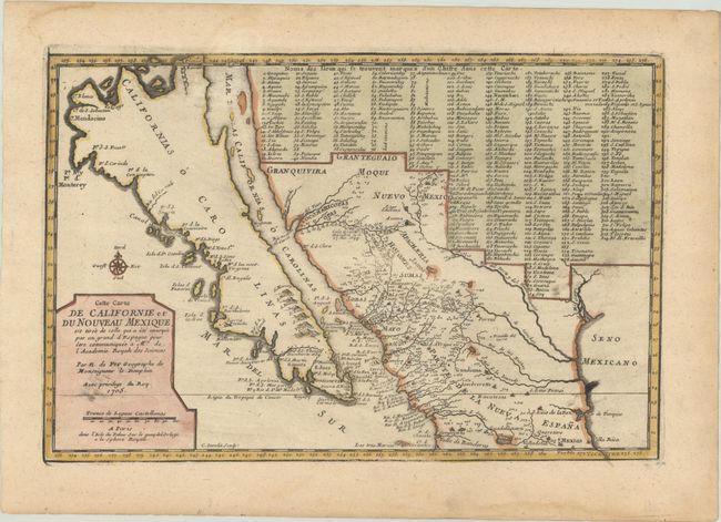
Auction 202, Lot 269
Subject: Southwestern United States & Mexico, California
Fer, Nicolas de
Cette Carte de Californie et du Nouveau Mexique, est Tiree de Celle qui a ete Envoyee par un Grand d'Espagne pour etre Communiquee a Mrs. de l'Academie Royale des Sciences, 1705
Size: 13.3 x 8.8 inches (33.8 x 22.4 cm)
Estimate: $1,000 - $1,300
De Fer's Important Map of the Island of California
Sold for: $750
Closed on 2/12/2025
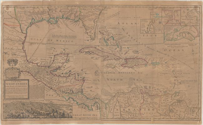
Auction 202, Lot 289
Subject: Gulf of Mexico & Caribbean
Moll, Herman
A Map of the West-Indies or the Islands of America in the North Sea; with ye Adjacent Countries; Explaning What Belongs to Spain, England, France, Holland &c..., 1730
Size: 39.8 x 23.1 inches (101.1 x 58.7 cm)
Estimate: $1,400 - $1,700
Moll's Two-Sheet Map Showing Colonial Possessions with Large View of Mexico City
Sold for: $1,400
Closed on 2/12/2025
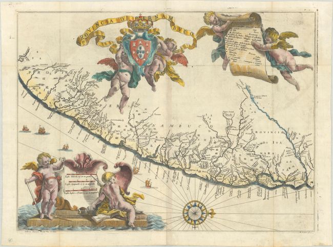
Auction 202, Lot 330
Subject: Eastern Brazil
Horatius, Andreas Antonius
Provincia di Pernambuco, 1698
Size: 19.9 x 14.8 inches (50.5 x 37.6 cm)
Estimate: $700 - $900
A Rare Map of Pernambuco from the "Santa Teresa"
Sold for: $700
Closed on 2/12/2025
3 lots