Showing No Reserve Lots(remove filter)
Filtered by Category:Books, Atlases, Travel Guides, Geography & Reference Books(Show All Categories)
Showing results for:Auction 198
Catalog Archive
22 lots
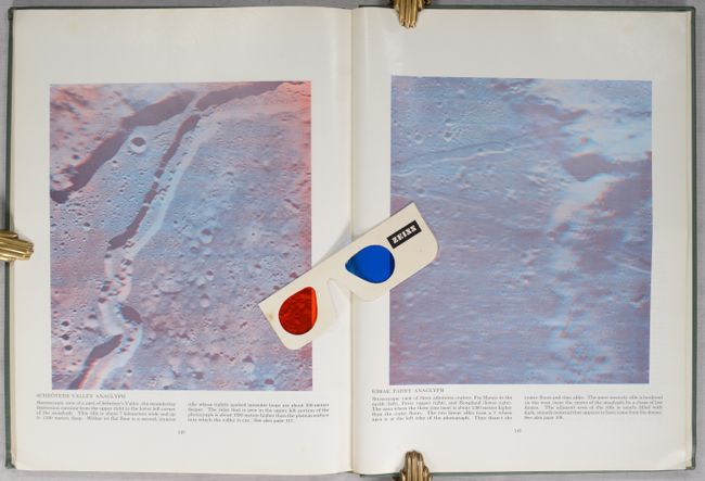
Auction 198, Lot 36
Subject: Moon
The Moon as Viewed by Lunar Orbiter, 1970
Size: 10.6 x 14.1 inches (26.9 x 35.8 cm)
Estimate: $50 - $80
NO RESERVE - Includes 3-D Glasses and Stereoscopic Images!
Sold for: $160
Closed on 6/19/2024
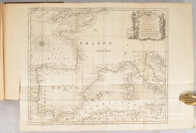
Auction 198, Lot 728
Subject: Miscellaneous Books
Kitchin, Thomas
[3 Maps in Book] The Annual Register, or a View of the History, Politicks, and Literature, for the Year 1763. The Second Edition, 1765
Size: 5.3 x 8.3 inches (13.5 x 21.1 cm)
Estimate: $140 - $170
NO RESERVE
Sold for: $65
Closed on 6/19/2024
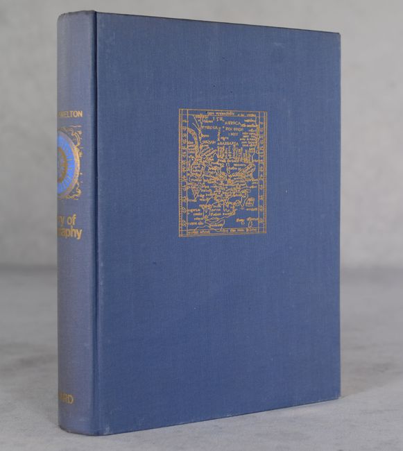
Auction 198, Lot 730
Subject: References
Bagrow, Leo
History of Cartography, 1966
Size: 7.6 x 10.9 inches (19.3 x 27.7 cm)
Estimate: $35 - $45
NO RESERVE
Sold for: $160
Closed on 6/19/2024
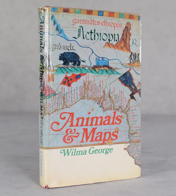
Auction 198, Lot 731
Subject: References
George, Wilma
Animals and Maps, 1969
Size: 6.3 x 9.8 inches (16 x 24.9 cm)
Estimate: $25 - $40
NO RESERVE
Sold for: $130
Closed on 6/19/2024
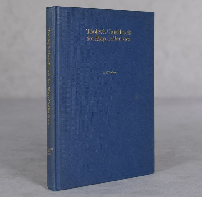
Auction 198, Lot 732
Subject: References
Tooley, R. V.
Tooley's Handbook for Map Collectors - A Subject Index Record, 1985
Size: 6 x 8.5 inches (15.2 x 21.6 cm)
Estimate: $25 - $45
NO RESERVE
Sold for: $15
Closed on 6/19/2024
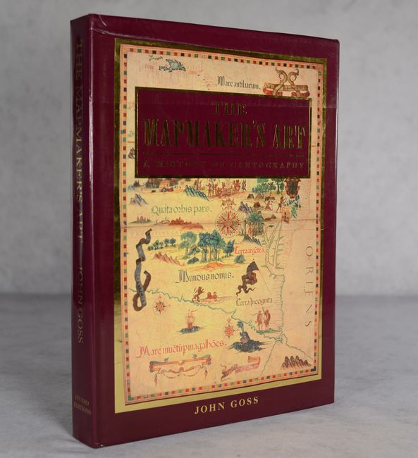
Auction 198, Lot 733
Subject: References
Goss, John
The Mapmaker's Art - A History of Cartography, 1993
Size: 10.9 x 14.9 inches (27.7 x 37.8 cm)
Estimate: $90 - $120
NO RESERVE
Sold for: $75
Closed on 6/19/2024

Auction 198, Lot 735
Subject: References, Explorers & Mapmakers
[Lot of 2] Explorers' Maps - Chapters in the Cartographic Record of Geographical Discovery [and] Maps and Map-Makers, 1958-62
Size: See Description
Estimate: $60 - $80
NO RESERVE
Sold for: $31
Closed on 6/19/2024
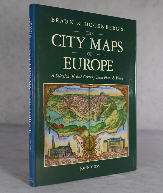
Auction 198, Lot 736
Subject: References, Braun & Hogenberg
Goss, John
Braun & Hogenberg's The City Maps of Europe - A Selection of 16th Century Town Plans & Views, 1991
Size: 11.4 x 15.3 inches (29 x 38.9 cm)
Estimate: $60 - $80
NO RESERVE
Sold for: $110
Closed on 6/19/2024
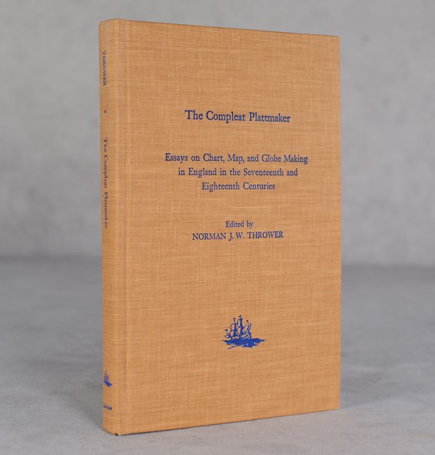
Auction 198, Lot 737
Subject: References, English Mapmakers
Thrower, Norman
The Compleat Plattmaker - Essays on Chart, Map, and Globe Making in England in the Seventeenth and Eighteenth Centuries, 1978
Size: 6.4 x 9.6 inches (16.3 x 24.4 cm)
Estimate: $25 - $40
NO RESERVE
Sold for: $55
Closed on 6/19/2024
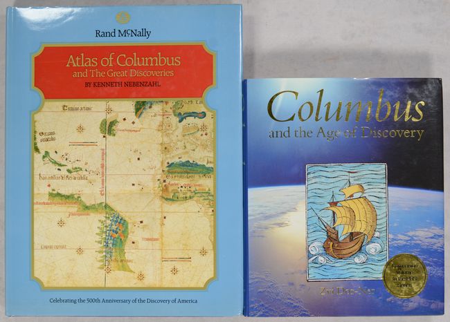
Auction 198, Lot 738
Subject: References, Columbus
[Lot of 2] Atlas of Columbus and the Great Discoveries [and] Columbus and the Age of Discovery, 1990-91
Size: See Description
Estimate: $60 - $80
NO RESERVE
Sold for: $95
Closed on 6/19/2024
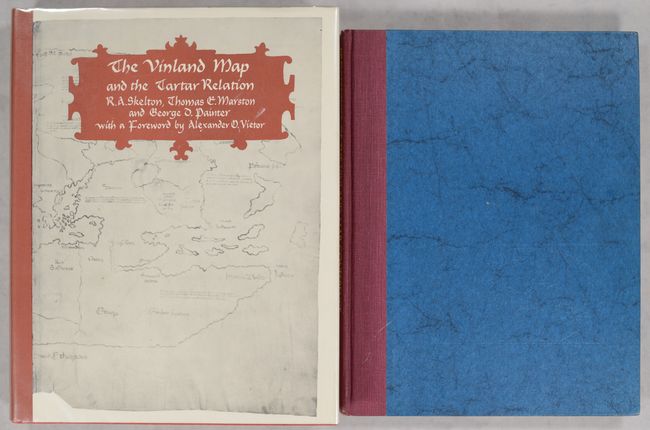
Auction 198, Lot 740
Subject: References, Vinland Map
[Lot of 2] The Vinland Map and the Tartar Relation [and] Proceedings of the Vinland Map Conference, 1965-71
Size: See Description
Estimate: $80 - $100
NO RESERVE
Sold for: $41
Closed on 6/19/2024
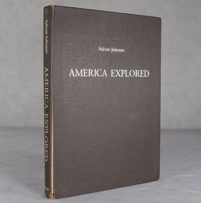
Auction 198, Lot 741
Subject: References, North America
Johnson, Adrian
America Explored - A Cartographical History of the Exploration of North America, 1974
Size: 10.3 x 13.9 inches (26.2 x 35.3 cm)
Estimate: $20 - $40
NO RESERVE
Sold for: $120
Closed on 6/19/2024
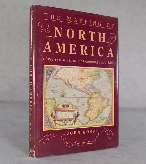
Auction 198, Lot 742
Subject: References, North America
Goss, John
The Mapping of North America - Three Centuries of Map-Making 1500-1860, 1990
Size: 10.3 x 14.4 inches (26.2 x 36.6 cm)
Estimate: $60 - $75
NO RESERVE
Sold for: $29
Closed on 6/19/2024
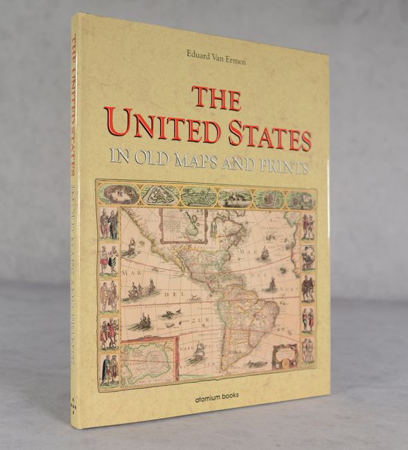
Auction 198, Lot 743
Subject: References, United States
Ermen, Eduard, van
The United States in Old Maps and Prints, 1990
Size: 12 x 15.2 inches (30.5 x 38.6 cm)
Estimate: $25 - $40
NO RESERVE
Sold for: $6
Closed on 6/19/2024
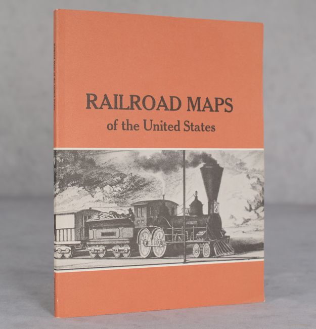
Auction 198, Lot 744
Subject: References, United States, Railroads
Modelski, Andrew M.
Railroad Maps of the United States - A Selected Annotated Bibliography of Original 19th-Century Maps in the Geography and Map Division of the Library of Congress, 1975
Size: 7.9 x 10.3 inches (20.1 x 26.2 cm)
Estimate: $50 - $70
NO RESERVE
Sold for: $36
Closed on 6/19/2024
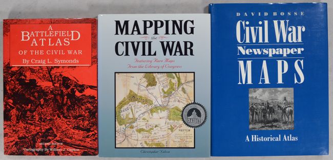
Auction 198, Lot 745
Subject: References, United States, Civil War
[Lot of 3] A Battlefield Atlas of the Civil War [and] Mapping the Civil War Featuring Rare Maps from the Library of Congress [and] Civil War Newspaper Maps - A Historical Atlas, 1987-93
Size: See Description
Estimate: $45 - $65
NO RESERVE
Sold for: $41
Closed on 6/19/2024
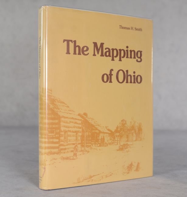
Auction 198, Lot 747
Subject: References, Ohio
The Mapping of Ohio - The Delineation of the State of Ohio Through the Use of Manuscript Maps, Printed Maps, and Plats..., 1977
Size: 9.2 x 12 inches (23.4 x 30.5 cm)
Estimate: $60 - $80
NO RESERVE
Sold for: $6
Closed on 6/19/2024
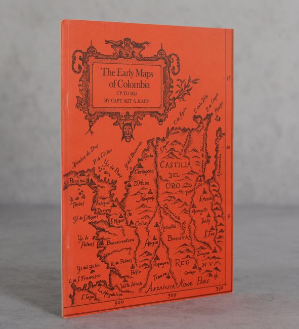
Auction 198, Lot 748
Subject: References, Colombia
Kapp, Kit S.
The Early Maps of Colombia Up to 1825, 1971
Size: 7.3 x 9.8 inches (18.5 x 24.9 cm)
Estimate: $55 - $70
NO RESERVE
Sold for: $17
Closed on 6/19/2024
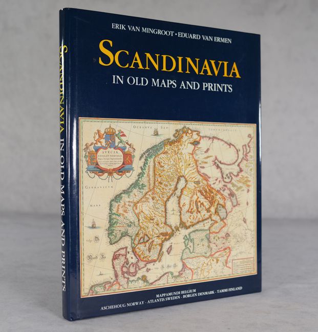
Auction 198, Lot 749
Subject: References, Scandinavia
Scandinavia in Old Maps and Prints, 1987
Size: 12.1 x 15.3 inches (30.7 x 38.9 cm)
Estimate: $70 - $90
NO RESERVE
Sold for: $60
Closed on 6/19/2024
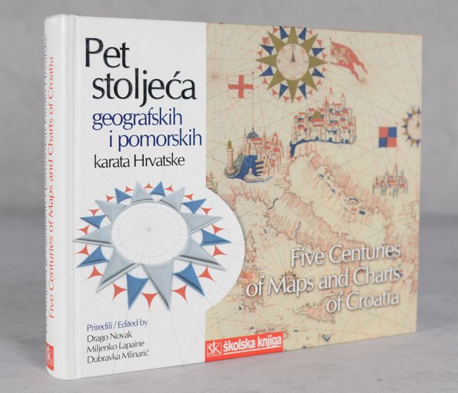
Auction 198, Lot 750
Subject: References, Croatia
Five Centuries of Maps and Charts of Croatia - Pet Stoljeca Geografskih i Pomorskin Karata Hrvatske, 2005
Size: 11.4 x 9.4 inches (29 x 23.9 cm)
Estimate: $50 - $70
NO RESERVE
Sold for: $34
Closed on 6/19/2024
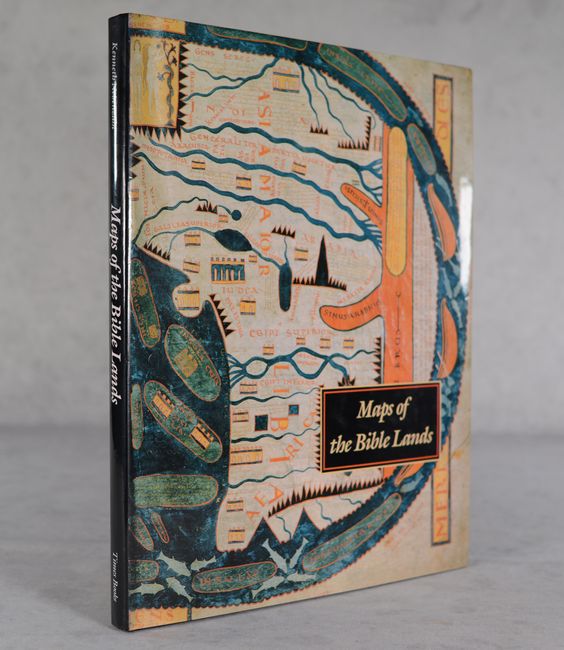
Auction 198, Lot 751
Subject: References, Holy Land
Nebenzahl, Kenneth
Maps of the Bible Lands - Images of Terra Sancta Through Two Millennia, 1986
Size: 12.1 x 15.3 inches (30.7 x 38.9 cm)
Estimate: $70 - $90
NO RESERVE
Sold for: $65
Closed on 6/19/2024
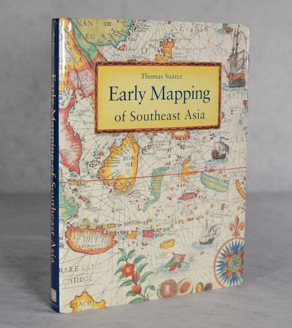
Auction 198, Lot 752
Subject: References, Southeast Asia
Suarez, Thomas
Early Mapping of Southeast Asia, 1999
Size: 9.4 x 12.4 inches (23.9 x 31.5 cm)
Estimate: $70 - $90
NO RESERVE
Sold for: $80
Closed on 6/19/2024
22 lots