Filtered by Category:Books, Atlases, Travel Guides, Geography & Reference Books(Show All Categories)
Showing results for:Auction 193
Catalog Archive
49 lots
Auction 193, Lot 63
Subject: Cartographic Miscellany, Literature
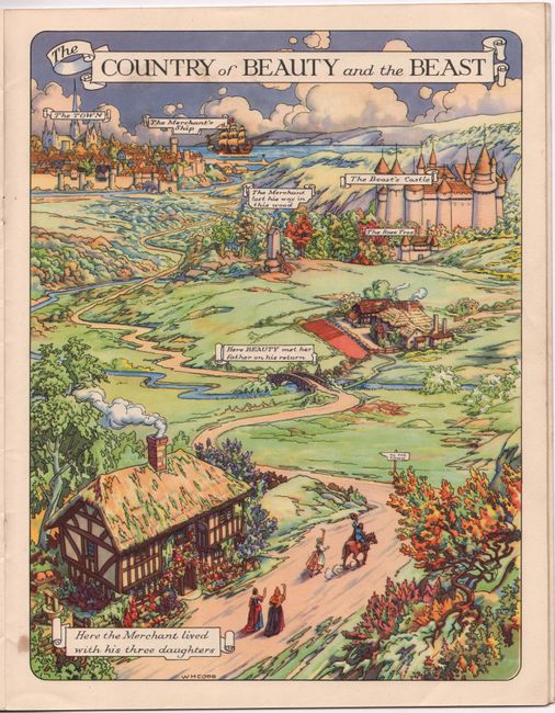
Atlas of Fairyland, 1948
Size: 9.8 x 12.6 inches (24.9 x 32 cm)
Estimate: $240 - $300
Sold for: $275
Closed on 6/21/2023
Auction 193, Lot 115
Subject: United States & Canada
Hitchcock, Edward
[Map with Book] A Geological Map of the United States and Canada [with] Outline of the Geology of the Globe, and of the United States in Particular..., 1854
Size: 24.4 x 16.3 inches (62 x 41.4 cm)
Estimate: $400 - $475
Sold for: $300
Closed on 6/21/2023
Auction 193, Lot 138
Subject: United States, Railroads
U.S. Government
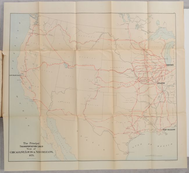
[8 Maps in Report] Report on the Internal Commerce of the United States, 1879
Size: 6.1 x 9.3 inches (15.5 x 23.6 cm)
Estimate: $160 - $190
Nimmo's Critical First Report on Railroads
Sold for: $220
Closed on 6/21/2023
Auction 193, Lot 141
Subject: United States
[Map with Book] Martin Ulvestads Kart over de Forenede Stater og "Norge I Amerika" [on verso] Marti Ulvestads Kart over Nordvesten og Hovedstroget af "Norge I Amerika" [with] Norge I Amerika med Kart, 1901
Size: 27.1 x 18 inches (68.8 x 45.7 cm)
Estimate: $400 - $500
Documents Norwegian Migration to the United States
Unsold
Closed on 6/21/2023
Auction 193, Lot 201
Subject: Western United States
Hayden, Ferdinand Vandeveer
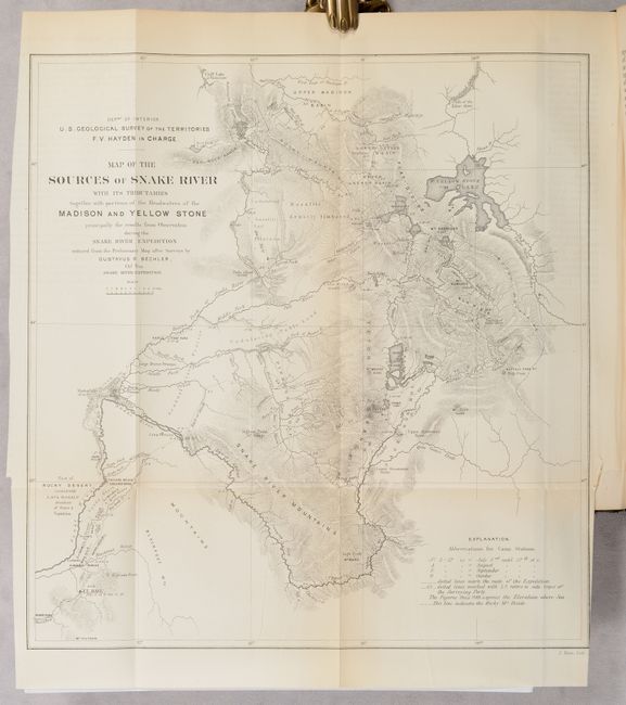
[3 Maps in Report] Sixth Annual Report of the United States Geological Survey of the Territories, Embracing Portions of Montana, Idaho, Wyoming, and Utah..., 1873
Size: 6 x 9.2 inches (15.2 x 23.4 cm)
Estimate: $240 - $300
Features Maps of Yellowstone
Sold for: $130
Closed on 6/21/2023
Auction 193, Lot 218
Subject: Arizona, New Mexico & Utah
U.S. Geological Survey (USGS)
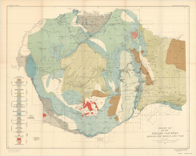
[2 Maps with Report] Geologic Map of the Navajo Country Arizona, New Mexico, and Utah [and] Map of the Navajo Country Arizona, New Mexico, and Utah [with] Geology of the Navajo Country..., 1917
Size: 29.6 x 23 inches (75.2 x 58.4 cm)
Estimate: $220 - $250
Sold for: $160
Closed on 6/21/2023
Auction 193, Lot 226
Subject: California
U.S. Bureau of Ethnology
Bureau of American Ethnology Bulletin 78 - Handbook of the Indians of California, 1919
Size: 6 x 9.3 inches (15.2 x 23.6 cm)
Estimate: $180 - $220
Sold for: $130
Closed on 6/21/2023
Auction 193, Lot 236
Subject: Los Angeles, California
Ord, E. O. C.
[Map in Report] Topographical Sketch of Los Angeles Plains & Vicinity. August 1849 [in] Report of the Secretary of War, Communicating Information in Relation to the Geology and Topography of California, 1850
Size: 6.2 x 7.4 inches (15.7 x 18.8 cm)
Estimate: $240 - $300
First "Official" Map of Los Angeles
Sold for: $150
Closed on 6/21/2023
Auction 193, Lot 290
Subject: Oklahoma
U.S. Department of Interior
[10 Maps in Report] Eighth Annual Report of the Commission to the Five Civilized Tribes to the Secretary of the Interior for the Fiscal Year Ended June 30, 1901, 1901
Size: 5.8 x 9.1 inches (14.7 x 23.1 cm)
Estimate: $300 - $400
Sold for: $275
Closed on 6/21/2023
Auction 193, Lot 300
Subject: West Texas
U.S. Geological Survey (USGS)
Geologic Atlas of the United States - Van Horn Folio Texas, 1914
Size: 18.6 x 21.8 inches (47.2 x 55.4 cm)
Estimate: $110 - $140
NO RESERVE
Unsold
Closed on 6/21/2023
Auction 193, Lot 315
Subject: Mexico
Herrera y Tordesillas, Antonio de
[Map in Book] An Hidrographical Draught of Mexico as It Lies in Its Lakes [in] The General History of the Vast Continent and Islands of America, Commonly Call'd, the West-Indies, from the First Discovery Thereof..., 1726
Size: 8.3 x 6.6 inches (21.1 x 16.8 cm)
Estimate: $250 - $325
Sold for: $300
Closed on 6/21/2023
Auction 193, Lot 370
Subject: Western South America
Aa, Pieter van der
[Map in Disbound Book] Zee en Land Togt door Fr. Pizarrus en D. Almagrus van Panama Gedaan na Peru, 1706
Size: 8.9 x 6 inches (22.6 x 15.2 cm)
Estimate: $475 - $600
Sold for: $350
Closed on 6/21/2023
Auction 193, Lot 415
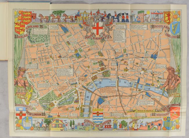
Subject: London, England
Children's Map of London [in] The Children's Book of London, 1948
Size: 28.9 x 21 inches (73.4 x 53.3 cm)
Estimate: $200 - $230
Sold for: $150
Closed on 6/21/2023
Auction 193, Lot 460
Subject: Antwerp, Belgium
The New Monumental Plan for Visitors to Antwerp [in] Antwerp Guide Brabo..., 1930
Size: 26.2 x 19 inches (66.5 x 48.3 cm)
Estimate: $160 - $200
Sold for: $90
Closed on 6/21/2023
Auction 193, Lot 473
Subject: France, Atlases
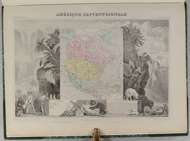
Levasseur, Victor
Atlas National Illustre des 89 Departements et des Possessions de la France Divise par Arrondissements, Cantons et Communes..., 1869
Size: 14.9 x 20.6 inches (37.8 x 52.3 cm)
Estimate: $750 - $900
Sold for: $500
Closed on 6/21/2023
Auction 193, Lot 589
Subject: Adriatic Sea & Ionian Sea
Bellin, Jacques Nicolas
Description Geographique du Golfe de Venise et de la Moree..., 1771
Size: 8.1 x 10.5 inches (20.6 x 26.7 cm)
Estimate: $1,900 - $2,200
Bellin's Complete Work on the Adriatic Sea and the Western Coasts of Greece
Sold for: $1,200
Closed on 6/21/2023
Auction 193, Lot 748
Subject: Atlases
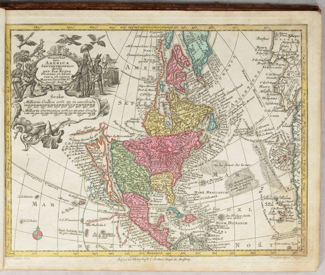
Lotter, Tobias Conrad
Atlas Minor Praecipua Orbis Terrarum Imperia, Regna et Provincias, Germaniae Potissimum..., 1745
Size: 11.4 x 8.9 inches (29 x 22.6 cm)
Estimate: $1,900 - $2,200
Small Atlas with 20 Maps Featuring Geographic Myths
Sold for: $1,800
Closed on 6/21/2023
Auction 193, Lot 749
Subject: Atlases
Laporte, Joseph de
[2 Volumes] Bibliotheque Universelle des Dames. Premiere Classe. Atlas, 1786
Size: 3.3 x 5.1 inches (8.4 x 13 cm)
Estimate: $1,200 - $1,500
A Pocket Atlas for Ladies with 28 Maps
Sold for: $900
Closed on 6/21/2023
Auction 193, Lot 750
Subject: Atlases
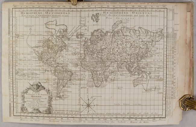
Philippe De Pretot, Etienne Andre
Recueil de Cartes pour l'Etude de l'Histoire Ancienne..., 1787
Size: 7.9 x 10 inches (20.1 x 25.4 cm)
Estimate: $500 - $650
Sold for: $350
Closed on 6/21/2023
Auction 193, Lot 751
Subject: Atlases
Walch, Johannes
Neuester Schul-Atlass nach den Bewahrtesten Hulfsmitteln..., 1818
Size: 10.9 x 8.8 inches (27.7 x 22.4 cm)
Estimate: $500 - $650
Sold for: $425
Closed on 6/21/2023
Auction 193, Lot 752
Subject: Atlases, Texas
Tardieu, Ambroise
Atlas Classique des Cinq Parties du Monde..., 1845
Size: 11.5 x 16.3 inches (29.2 x 41.4 cm)
Estimate: $400 - $475
Sold for: $275
Closed on 6/21/2023
Auction 193, Lot 753
Subject: Atlases
Mitchell/Cowperthwait
Mitchell's School Atlas: Comprising the Maps and Tables Designed to Accompany Mitchell's School and Family Geography, 1856
Size: 9.8 x 12 inches (24.9 x 30.5 cm)
Estimate: $150 - $180
Sold for: $130
Closed on 6/21/2023
Auction 193, Lot 754
Subject: Atlases
Jones, C. H.
Historical Atlas of the World Illustrated..., 1882
Size: 14.9 x 19.9 inches (37.8 x 50.5 cm)
Estimate: $500 - $650
Sold for: $375
Closed on 6/21/2023
Auction 193, Lot 755
Subject: Atlases
Bradley, William M. [& Bros.]
Bradley's Atlas of the World for Commercial and Library Reference..., 1886
Size: 13.8 x 19.6 inches (35.1 x 49.8 cm)
Estimate: $400 - $475
Sold for: $275
Closed on 6/21/2023
Auction 193, Lot 756
Subject: Geography Books
Gordon, Patrick
Geography Anatomiz'd: or the Geographical Grammar. Being a Short and Exact Analysis of the Whold Body of Modern Geography..., 1749
Size: 5 x 8.1 inches (12.7 x 20.6 cm)
Estimate: $375 - $450
Sold for: $275
Closed on 6/21/2023
Auction 193, Lot 757
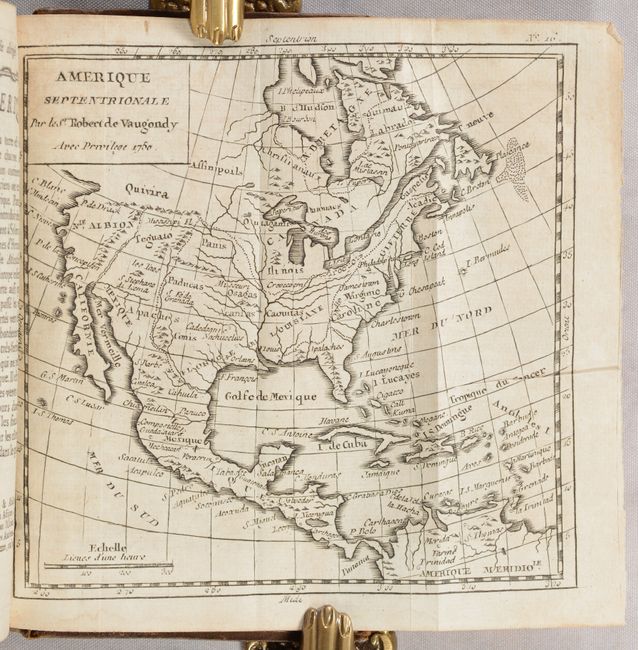
Subject: Geography Books
Robert de Vaugondy, Didier
Methode Abregee et Facile pour Apprendre la Geographie..., 1777
Size: 4 x 6.8 inches (10.2 x 17.3 cm)
Estimate: $400 - $475
Sold for: $375
Closed on 6/21/2023
Auction 193, Lot 758
Subject: Exploration & Surveys, Japan, India & Philippines
Prevost, Anton Francois
Histoire Generale des Voyages, ou Nouvelle Collection de Toutes les Relations de Voyages ... Tome Dixieme, 1752
Size: 7.9 x 10.3 inches (20.1 x 26.2 cm)
Estimate: $700 - $850
Sold for: $500
Closed on 6/21/2023
Auction 193, Lot 759
Subject: Exploration & Surveys
Anson, George
A Voyage Round the World, in the Years MDCCXL, I, II, III, IV..., 1756
Size: 9.5 x 11.6 inches (24.1 x 29.5 cm)
Estimate: $950 - $1,200
Complete Edition of Anson's Voyage
Sold for: $475
Closed on 6/21/2023
Auction 193, Lot 760
Subject: Europe, Cities
Le Rouge, George Louis
Le Parfait Aide de Camp ou l'on Traite de ce que Doit Scavoir Tout Jeune Militaire qui se Propose de Faire son Chemin a la Guerre..., 1760
Size: 9.6 x 7.8 inches (24.4 x 19.8 cm)
Estimate: $550 - $700
Unsold
Closed on 6/21/2023
Auction 193, Lot 761
Subject: References, Facsimile Atlas
Braun & Hogenberg
[Facsimile - 6 Volumes] Beschreibung und Contrafactur der Vornembster Stat der Welt, 1965-70
Size: 17 x 23.2 inches (43.2 x 58.9 cm)
Estimate: $1,000 - $1,300
Sold for: $1,200
Closed on 6/21/2023
Auction 193, Lot 762
Subject: References, Facsimile Atlas
Jansson, Jan
[Facsimile] Novus Atlas Absolutissimus..., 1977
Size: 12.7 x 20 inches (32.3 x 50.8 cm)
Estimate: $240 - $300
Sold for: $180
Closed on 6/21/2023
Auction 193, Lot 763
Subject: References
[Lot of 3] The Mapmaker's Art - Essays on the History of Maps [and] The Map as Art - Contemporary Artists Explore Cartography [and] The Art of the Map - An Illustrated History of Map Elements and Embellishments, 1953-2012
Size: See Description
Estimate: $70 - $90
NO RESERVE
Sold for: $110
Closed on 6/21/2023
Auction 193, Lot 764
Subject: References
[Lot of 2] Maps and Map-Makers [and] Decorative Printed Maps of the 15th to 18th Centuries, 1961-65
Size: See Description
Estimate: $80 - $100
NO RESERVE
Sold for: $11
Closed on 6/21/2023
Auction 193, Lot 765
Subject: References
Various
[Lot of 109] Map Collectors' Circle, 1963-75
Size: 7.3 x 9.8 inches (18.5 x 24.9 cm)
Estimate: $500 - $650
Sold for: $275
Closed on 6/21/2023
Auction 193, Lot 766
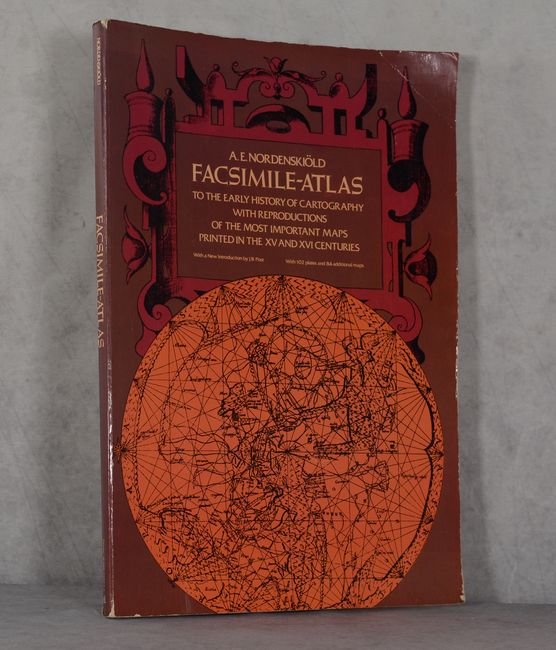
Subject: References
Nordenskiold, Nils Adolf E.
Facsimile-Atlas to the Early History of Cartography with Reproductions of the Most Important Maps Printed in the XV and XVI Centuries, 1973
Size: 11 x 16 inches (27.9 x 40.6 cm)
Estimate: $140 - $170
Sold for: $100
Closed on 6/21/2023
Auction 193, Lot 767
Subject: References, Mapmakers
Tooley, R. V.
[4 Volumes & Supplement] Tooley's Dictionary of Mapmakers, 1985-2004
Size: 7.2 x 10.2 inches (18.3 x 25.9 cm)
Estimate: $550 - $700
Sold for: $400
Closed on 6/21/2023
Auction 193, Lot 768
Subject: References, World
Shirley, Rodney W.
The Mapping of the World - Early Printed World Maps 1472-1700, 1983
Size: 9.6 x 13.6 inches (24.4 x 34.5 cm)
Estimate: $300 - $375
Sold for: $220
Closed on 6/21/2023
Auction 193, Lot 769
Subject: References, North America
Cummings, Skelton & Quinn
The Discovery of North America, 1971
Size: 9.3 x 12.1 inches (23.6 x 30.7 cm)
Estimate: $50 - $70
NO RESERVE
Sold for: $26
Closed on 6/21/2023
Auction 193, Lot 770
Subject: References, North America
Burden, Philip D.
The Mapping of North America - A List of Printed Maps 1511-1670, 1996
Size: 10.6 x 14.3 inches (26.9 x 36.3 cm)
Estimate: $200 - $230
Sold for: $190
Closed on 6/21/2023
Auction 193, Lot 771
Subject: References, United States
Fite & Freeman
A Book of Old Maps Delineating American History from the Earliest Days Down to the Close of the Revolutionary War, 1969
Size: 11 x 13.8 inches (27.9 x 35.1 cm)
Estimate: $70 - $90
NO RESERVE
Sold for: $60
Closed on 6/21/2023
Auction 193, Lot 772
Subject: References, Louisiana Territory
Charting Louisiana - Five Hundred Years of Maps, 2003
Size: 14.4 x 12.3 inches (36.6 x 31.2 cm)
Estimate: $120 - $150
Sold for: $90
Closed on 6/21/2023
Auction 193, Lot 773
Subject: References, Western United States
Wheat, Carl I.
[5 Volumes in 6 Books] 1540-1861 Mapping the Transmississippi West, 1995
Size: 9.3 x 12.4 inches (23.6 x 31.5 cm)
Estimate: $475 - $600
Sold for: $375
Closed on 6/21/2023
Auction 193, Lot 774
Subject: References, Hawaii
The Early Mapping of Hawai'i Volume I Palapala 'aina, 1986
Size: 10.4 x 14.3 inches (26.4 x 36.3 cm)
Estimate: $70 - $90
NO RESERVE
Sold for: $45
Closed on 6/21/2023
Auction 193, Lot 775
Subject: References, Boston
Mapping Boston, 1999
Size: 12.3 x 11.8 inches (31.2 x 30 cm)
Estimate: $70 - $90
Sold for: $50
Closed on 6/21/2023
Auction 193, Lot 776
Subject: References, Mexico, Central America, West Indies, & South America
[4 Volumes] A Catalogue of Maps of Hispanic America Including Maps in Scientific Periodicals and Books and Sheet and Atlas Maps..., 1930-33
Size: 6.7 x 10.3 inches (17 x 26.2 cm)
Estimate: $140 - $170
Sold for: $325
Closed on 6/21/2023
Auction 193, Lot 777
Subject: References, Britain
Shirley, Rodney W.
Printed Maps of the British Isles 1650-1750, 1988
Size: 9 x 11.1 inches (22.9 x 28.2 cm)
Estimate: $90 - $110
NO RESERVE
Sold for: $16
Closed on 6/21/2023
Auction 193, Lot 778
Subject: References, Arabia
Arabia in Early Maps - A Bibliography of Maps Covering the Peninsula of Arabia Printed in Western Europe from the Invention of Printing to the Year 1751, 1978
Size: 8.6 x 10.1 inches (21.8 x 25.7 cm)
Estimate: $120 - $150
Sold for: $90
Closed on 6/21/2023
Auction 193, Lot 779
Subject: References, Japan
Walter, Lutz
Japan - A Cartographic Vision - European Printed Maps from the Early 16th to the 19th Century, 1994
Size: 9.5 x 12.3 inches (24.1 x 31.2 cm)
Estimate: $60 - $80
NO RESERVE
Sold for: $21
Closed on 6/21/2023
Auction 193, Lot 780
Subject: References, Africa
Norwich, Oscar I.
Maps of Africa - An Illustrated and Annotated Carto-Bibliography, 1983
Size: 9 x 11.8 inches (22.9 x 30 cm)
Estimate: $70 - $90
Sold for: $50
Closed on 6/21/2023
49 lots


